


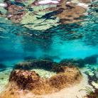
Ceja jug
South side of the islet of Ceja
Ceja island is part of the Medulin archipelago located on the eastern side of the Kamenjak peninsula, across from the small Školjić peninsula. It is part of the significant landscape of Donji Kamenjak and the Medulin archipelago.
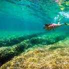
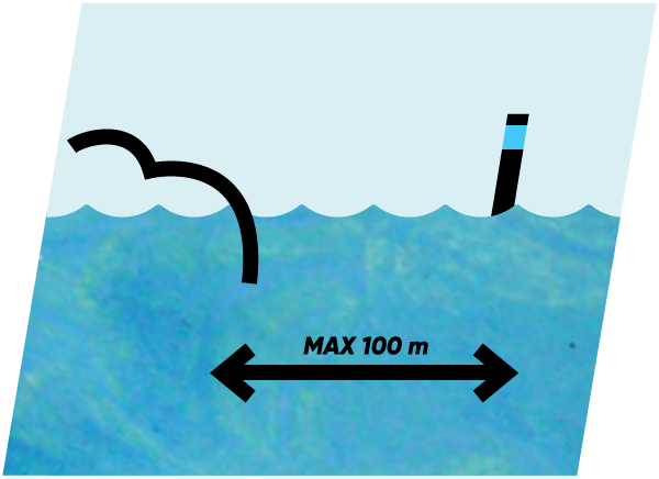
You can reach Ceja by an excursion boat that departs from the Medulin waterfront, by taxi boat from Medulin and Premantura, or by kayak. This snorkeling location is located on the south side of the island. If you take an aerial view of Ceja, you will notice the edges of the rocks separating from the coast on the southern side and entering the sea as if someone had carefully combed them. Namely, the entire islet features intertwining lines that are visible even on the nearby shallows marked with a green pole.
Curiosities of the sea
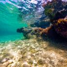
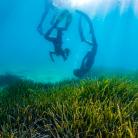
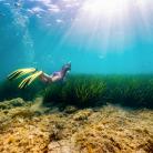
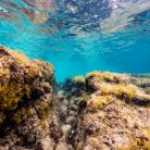
You can start exploring this snorkeling location at the first small cove covered with white pebbles. While swimming, follow the ridge that plunges into the sea and after 20 meters you will come across a rock resembling a chimney. This is where the paths cut into the sloping stone plateau fork allowing you to explore them all. In these furrows you can meet colourful painted combers, the peacock wrasse, damselfish, but also a small fish called the pointed-snout wrasse. You will easily recognize it by its elongated, pointed head slightly bent upwards. It is mostly brown with a prominent light-green line that stretches along the middle of its head to the mouth. It is interesting that this little fish builds a nest of tiny snails and shells, but it is very shy, so you will have to follow it secretly.
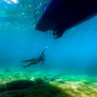
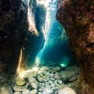
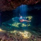
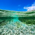
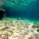
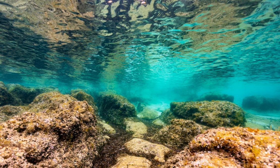
The main attraction of this location is at the next beach, along the coast itself. Simply by following the coastline you will notice a small channel along the beach through which the sea enters deep into the rocks. Go around it from the sea side and you will reach the entrance to a passable, short tunnel. Sun rays illuminate and dot the rocky stone-scattered bottom. The depth at the entrance to the tunnel is 2 meters, after which it becomes more shallow. It is wide enough for a comfortable 1-meter dive, which leads you out to the previously mentioned sea channel, from which you can swim out to the beach. The plateau around the tunnel is made of polished white stone characterized by its round lines, with small rounded stone hills standing out like a ball.
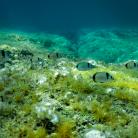
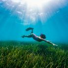
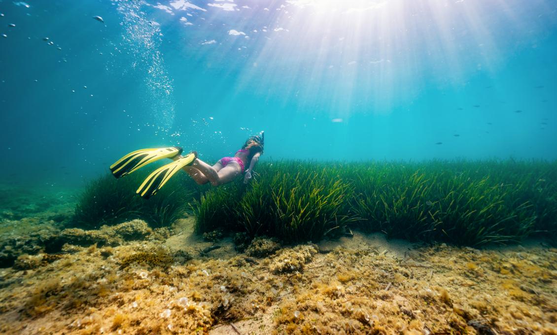
The bottom gradually descends to a depth of 3 meters, where the furrows merge into a wider sandy bottom channel, most often covered with torn brown leaves of Posidonia oceanica (Neptune grass). Densely shaped posidonia meadows are located a little further, at a depth of 6 meters and extend all the way to the nearby shallows. This seagrass is endemic to the Mediterranean Sea. It was named after Poseidon, the Greek god of the sea (lat. Posidonia oceanica), but it is also called voga or lažina. These meadows are temporary or permanent habitats of numerous animal species for which it represents a safe shelter as well as food and breeding grounds, and are of great importance for the marine ecosystem. Given that Ceja is immersed in the open waters of Kvarner, constant and strong currents ensure the exchange and purity of the water, which favours Posidonia's development because it is very sensitive to impurity and changes in salinity. It is truly magical to observe its elegant sway made by sea currents, which seems almost hypnotic.
Here one can see cuttlefish, red scorpionfish, sheephead breams, shoals of sea bass and grey mullet, as well as the strictly protected cowrie shell, which is easily recognizable by the oval shape of its porcelain-like house. It is brown in colour as if varnished with two lighter transversal stripes. It has a narrow and toothed aperture on the underside. It is strictly prohibited to take it out of its natural habitat.
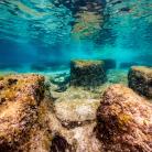
If you continue to explore further, along the coast itself, you will come across another white pebble beach with a remaining metal part, which could be a remnant of an ancient shipwreck. Namely, the small islands of the Medulin archipelago remember various pirate raids terrorizing these shores in the 16th and 17th centuries.
During the 16th century, naval skirmishes between Venice and Austria intensified in these waters due to border conflicts, free navigation, import and export of goods (especially salt), but also the growing problem with Uskoks (Senj pirates) who, encouraged by Austria, mercilessly attacked Venetian ships along the entire coast of Istria. However, archival sources also mention the Barbary and Ulcinj pirates who raided the coast around Pula and Premantura. It was recorded that in 1672 they anchored at Ceja and attacked a Venetian ship.
Safety first
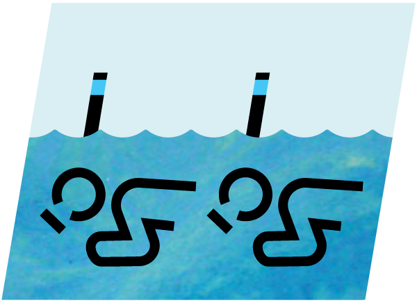
If visiting this snorkeling location, one should be careful when moving away from the coast due to intense maritime traffic. If you want to visit the nearby shoal, marked with a green pole (post) and located approximately 200 meters from Ceja, it is best to come by kayak or sup from Kamenjak, but keep in mind that the sea currents can be very strong as the bottom is shallow, 2 to 3 meters on average.
Curiosities
This snorkeling location is excellent for underwater photography and exploring the traces of ancient shipwrecks. The remains of amphorae as well as of recent shipwrecks that had accidentally ended up on the rock of this shoal can be found. If you do find any of these, bear in mind that they are unfortunate "souvenirs", accompanied by the sounds of wailing, shots from arquebuses or clanging of swords. Do not touch them, but leave them there to continue to bear witness to the turbulent past of this archipelago...


