Explore Raša

The youngest town in Istria, Raša (Arsia), was named after the river of the same name. Although it is white because of the stone and concrete, Raša was in fact built of coal. The town's history began in the 1930s when, serving the needs of miners and mining, a town sprang up in the valley of Krapan stream. In this newly-built town workers' houses set along two parallel streets meet at the central square with the church in the shape of a turned over coal wagon while its bell tower reminds of miner's lamp. Today its appearance is part of a memory album of town planning, whereas the sound of coal wagons belongs to bygone days.

Town and surroundings

  • St Marina

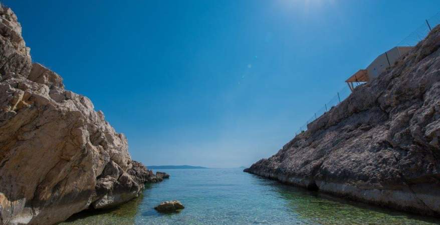
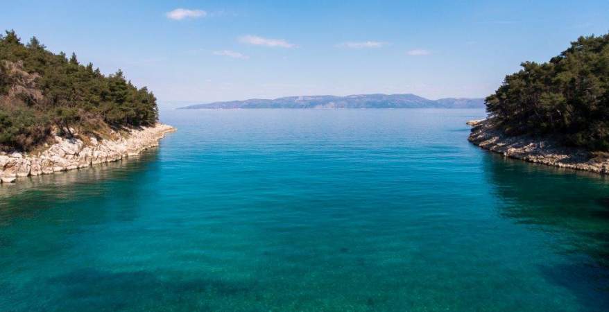
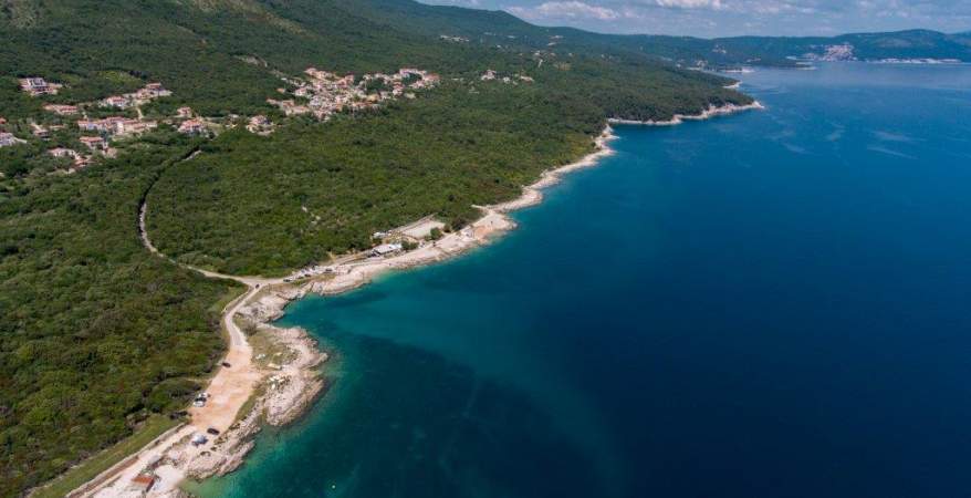
    St. Marina is a picturesque seaside resort situated on the east coast of Istrian. A small peninsula covered in olive-groves and a church of St. Marina closes a quiet bay with a village and fertile valley in the bottom of it.

    The oldest settlement traces were found in the surroundings of today’s Sv. Marina, including several Bronze Age hill forts and stone barrows. Appropriate strategic position, pleasant climate and fertile land caused Roman families to start settling here in the course of the 1st and 2nd century. One of the Roman objects was located on the southern part of the peninsula, on the spot where now stands the church of St. Marina.

    A Roman villa rustica was built there, and its ruins were still visible at the beginning of the 20th century. Next to the villa on an unknown location there was a small necropolis (a cemetery), whose remains were discovered at the beginning of the last century. Several glass fragments found in the surroundings and a part of a window transenna (stone grille) which was part of an earlier church building belong to Late Antiquity and the Early Middle Ages. 

    The church of St. Marina was reconstructed in the 12th/13th century, when there was a medieval cemetery in its yard. The church serves as a proof of a medieval settlement whose traces are still to be discovered. According to a local tradition, there was once a nunnery near the church. The Venetian government has left us with no traces of its rule in Sv. Marina. It is assumed that the place was inhabited at that time and there was a small port in the bay. Sv. Marina began to flourish in the early 19th century when the whole of Labin area thanks to mining started to develop more intensively. Bigger and modern houses, covered in roofing tiles were built in Sv. Marina, and its inhabitants got engaged in trading and maritime affairs. At the beginning of the 20th century there were a shop, a café and a small police office (in order to prevent smuggling at sea) in Sv. Marina. A primary school with lessons in Croatian, started by St. Cyril and Methodius association, was working from 1905-1919. 

    After the war the village gradually started to die out, with part of its inhabitants leaving that time Yugoslavia or moving to larger cities, the school closed down, and the sailing boats were nationalized. The new revival took place in the early 1980s with the new industry-tourism. A camping site Marina was opened in 1981, with a capacity of 400 people, whereas now it can host 750 people. Sv. Marina today is all tourism-oriented, other than the camping site; there is also private accommodation available, cafés and restaurants, and a diving center within the camping site.

  • Drenje, Ravni

    Drenje and Ravni settlements, small tourist resorts, are situated on the eastern slopes of the Skitača village and down Oštri and Goli hilltops. Small villages of fishermen and sailors with poor hinterland are nowadays growing into real tourist centers. In the mid-1980s an apartment complex was built in Ravni, and a part of the coastline was arranged next to the complex.

    This process gave an impulse to further tourist development of Ravni and Drenje. Ravni is a favorite destination for wind surfers and divers.

    A church of St. Nicholas with a cemetery is located in Drenje. After analyzing the construction and church interior the object is was found that the church was built in the course of Baroque era. There is a bell cote on the façade. The built-in altar with a retable holds a wooden statue of St. Nicholas. The church was rebuilt in 1996.

  • Crna Punta

    Cape Crna punta (literally: the black cape) with a lighthouse is situated down the Skitača village. The lighthouse built in 1873 was constantly emitting the 4th order white light with 11 mile range. The lighthouse consists of a separate tower with light and a one storey building with the total area of 160 sq. m.

    A storage room and a motor engine unit are also part of this complex. There is no electricity in the building, and water is supplied from its own cistern. Thanks to this lighthouse the maritime route to Rijeka port and other Kvarner bay harbors was marked and safe for navigation.

    The surroundings of Crna punta is rich in forests that were exploited during the Venetian rule. A small dock was constructed just for that purpose near the lighthouse. The lighthouse is now operating automatically, with the last crew members leaving in the 1980s.

  • Koromačno

    Koromačno is a settlement in the southeastern part of the Istrian peninsula, located in the synonymous bay between the woody Ubas peninsula in the west and cape Koromačno in the east.

    The place was built thanks to cement factory, built in 1925, which used cement clay found on the near-by Gradac hill above Vošćica bay. There was a church of St. Joseph in the center of Koromačno, now out of function.

    Some of the most significant archaeological and historical sites of Raša municipality are located near Koromačno. At the end of 1980s in the Koromačno bay a 4th-5th century underwater amphorae site was discovered. An Early Bronze age/Iron Age hill-fort was found on Gradac hill (475 m), destroyed due to cement clay exploitation in the quarry. There was also a medieval tower Turan, owned by the Battiala family, built on the same hill.

    Facing north from the hill-fort there is a 13th-14th century church of St. John with 14th century frescos. This Romanesque church has a semicircular apse, and a porch and a bell cote on the façade were removed in 1993 during the restoration works.

  • Tunarica, Ubac

    Tunarica

    Tunarica is a bay and a small fishing village situated in the Raša bay. In the past the local people were traditionally engaged in fishing and maritime affairs and were especially famous for tuna fishing. During the prehistory this area was highly populated area (there are many hill forts and barrows).

    During the Roman Age one of the two known spots to cross the bay was located near Tunarica. In the 16th and 17th century Tunarica was owned by the Battiala family, whose members had their summer house built there. The ruins of the house can still be seen today next to the restaurant in the camping site, opened in 1972.

    Ubas Peninsula (Ubac, Ubaš)

    A peninsula and a cape of the same name-Ubas-are situated on the east side entering the Raša bay. Cape Ubas is also the southernmost point of the Labin area. There is a lighthouse built in 1887, which ensured secure entrance and navigation in at that time very important Raša bay. There are two prehistoric hill forts and a medieval church of St. Nicholas on the peninsula. During the Venetian rule the peninsula was owned by the Battiala family.

    In the course of World War II the central Partisan hospital for the area of Labin was located here, and in 1944 the Partisan headquarters for all Istrian units was transferred to Ubas. During WWII the Germans blew up the lighthouse thinking that there was a Partisan hospital in it. Thanks to its preserved Mediterranean flora and a large population of wild animals the Ubas peninsula is nowadays registered as a protected territory.


  • Trget

    Trget is a fishing village situated in the Raša bay. Its name comes from the verb ‘trgetarenje’ in Croatian (from the Latin word traiectum), which means ‘transport of people and goods from one side of the bay to the other’.

    There are ruins of the Romanesque church of St. Justin with a semicircular apse in the village center, and history books mention the existence of a medieval castle in Trget (Castello di San Giorgio).

    The village flourished at the end of the 19th century when a coal shipping harbor was built near-by. Numerous findings from the Antiquity were found in the hinterland of Trget.

Where would you like to stay?

Explore
Raša
5 °C
  • Wed
    9 ºC
  • Thu
    8 ºC
  • Fri
    11 ºC
source: DHMZ
How to get there?
  • Car
  • Bicycle
Time
-
-
9:30 h
0:30 h
Distance
-
-
276,4 km
277,4 km
source: Google Maps
Contact
Show